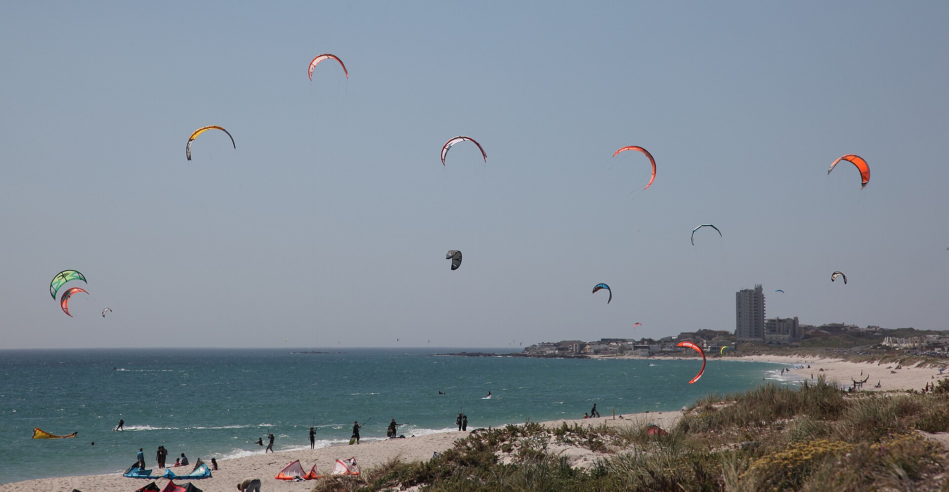
It is the first week of January, and the southeaster has been at it nearly every afternoon since before Christmas. Flags along Marine Drive have been standing stiff as boards, the kitesurfers off Table View are having the summer of their lives, and anyone who tried a late-afternoon picnic at Big Bay recently has learnt what beach sand feels like at 40 km/h. So this article answers its own question from inside the answer: Cape Town’s wind season is, right now, at full volume.
The short version is simple. The south-easterly season runs from roughly October to March, it peaks between November and January, and it fades through early autumn until April and May deliver the calmest weeks of the year. The longer version is more interesting, because once you understand why the wind blows, the calendar starts to make sense on its own.
The season runs from October to March, and the peak is now
Locals date the season loosely from the first proper multi-day blow, which usually arrives in late September or October, though the odd early southeaster can turn up from the end of August. By October the pattern has settled in: hot, clear days with the wind building through the afternoon. November and December are widely regarded as the most relentless stretch. January, where we are now, carries the peak onward with hot days and strong, reliable afternoons.
February still blows hard but starts handing out more rest days. Through March the season audibly winds down: the blows get shorter, the calm spells get longer, and by April the southeaster has mostly packed it in. On a typical strong day the wind runs at 30-50 km/h with stronger gusts, and Table Bay has recorded extreme readings of up to 160 km/h. That second figure is the exception, not the season; most southeaster days are merely emphatic rather than dangerous.
The wind’s nickname, the Cape Doctor, comes from an old belief that it swept disease and bad air out of the settlement. The medical claims have not aged well, but the underlying observation has: a few days of southeaster genuinely does scrub the haze off the City Bowl and the Cape Flats, which is why the windiest months are also the ones with that scoured, high-definition light.
A high-pressure cell in the Atlantic does most of the work
Here is the mechanism, minus the jargon. Out in the South Atlantic sits a vast, semi-permanent dome of sinking air called the South Atlantic High. Air constantly spills outward from it, and Cape Town happens to sit where that outflow arrives from the south-east. In winter the high drifts north and mostly leaves us alone. In summer it slides south and parks closer to the Cape, aiming its airflow straight at the peninsula for months at a time.
Summer adds a second ingredient. The southern African interior bakes under the sun and develops a broad zone of low pressure, and air always runs downhill from high pressure to low. The bigger that pressure gap, the harder the air runs. A big offshore high plus a hot inland low equals a steep gradient across the Cape, and the southeaster is simply that gradient made audible.
The mountains then edit the result. Table Mountain and the ranges behind False Bay squeeze, split and accelerate the flow, which is why one suburb can be flattened while another around the corner sits in near calm. The famous tablecloth on Table Mountain is part of the same process: moist air off False Bay is forced up the mountain’s slopes, cools, and condenses into that smooth cap of cloud, then warms and evaporates as it pours down the city side. When you see the tablecloth from the Blouberg side of the bay, you are looking at the southeaster made visible.
The season follows a fairly predictable arc
No two summers are identical, but the shape of the season repeats reliably enough to plan around. Treat the table below as the pattern, not a promise.
| Month | Dominant wind | What it usually feels like |
|---|---|---|
| September | South-east arriving | First real blows, still interrupted by late cold fronts |
| October | South-east | Season settles in; windy afternoons become the norm |
| November | South-east | Firmly in the windy stretch; calm days are scarce |
| December | South-east | Peak season; multi-day blows are common |
| January | South-east | Still peak; hot mornings, strong afternoons |
| February | South-east | Strong, but calm days appear more often |
| March | South-east easing | Season tapers; longer quiet spells |
| April-May | Light and variable | The calm window between the two wind regimes |
| June-August | North-west | Cold-front season: squally, wet, occasionally gale force |
One more rhythm sits inside the season: the southeaster tends to blow in cycles. A strong episode typically holds for two or three days, eases for a day or two, then rebuilds as the high re-establishes itself offshore. If you arrive mid-blow, the odds are good that a quieter day is not far off.
Winter’s wind is a different animal entirely
People sometimes assume the wind season ends and calm begins. Not quite. From about May to September the dominant wind flips to the north-west, arriving ahead of and during the cold fronts that roll off the Southern Ocean. These are shorter, wetter, moodier events: a day or two of rain, low cloud and blustery seas, then clearing skies behind the front.
The records show winter north-westers can match or exceed the southeaster in raw strength, and the big ones close the Table Mountain cableway and cancel Robben Island ferries. The difference is duration and mood. The southeaster is a dry, sunny wind that overstays its welcome; the north-wester is a storm wind that leaves quickly. Between fronts, winter also produces some of the stillest, glassiest mornings of the whole year on this coastline.
The wind keeps time with the sun
Within any summer day there is a schedule worth knowing. The southeaster is driven partly by the temperature gap between the heating land and the cool Atlantic, so it usually starts gently, builds through late morning, and hits its stride from early afternoon into the evening. Mornings are noticeably kinder.
That single fact organises a Blouberg summer day better than any forecast. Swim, walk or run before about 10:00; leave the afternoon to the kitesurfers, who plan their whole travelling year around exactly the hours everyone else avoids. Before you commit either way, it is worth checking a live wind reading for the Blouberg beachfront rather than a city-wide forecast, because conditions here can differ sharply from town.
Questions people ask about the wind season
Does the southeaster blow every single day in summer?
No. It blows in episodes, commonly two or three days at a stretch, with pauses in between. From November to February the majority of afternoons carry a working wind, which is precisely why the kiteboarding crowd treats Table Bay as a pilgrimage site, but genuinely still summer days do occur, and they are glorious.
When is Cape Town least windy?
April and May, the gap after the southeaster stands down and before the winter fronts arrive in earnest. If wind bothers you more than the chance of a cool evening, that window is the sweet spot for a West Coast visit.
Is January a bad time to visit Bloubergstrand?
Only if your entire plan is lying on the sand at 16:00. Structure the day around the wind, mornings on the beach, afternoons watching hundreds of kites from a sheltered spot, and January is arguably the area at its most alive.
What is a black southeaster?
A rare variant in which a cut-off low-pressure system combines with south-easterly flow to bring dark skies and heavy rain instead of the usual dry sunshine. The same broad setup was behind the Laingsburg flood of January 1981. If the southeaster arrives with thick grey cloud rather than a crisp blue sky, that is the version you are looking at, and it is worth taking the rainfall warnings seriously.
Sources & further reading
- The Cape Doctor | Cape Town Magazine
- Cape Town Wind Guide | Cape Town Current
- Cape Doctor | Wikipedia
- Kitesurfing Cape Town: Blouberg, Dolphin Beach, Big Bay | Freeride Kitesurf
- Avoiding the wind in Cape Town | Cape Town Travel
Featured image: Kitesurfers-001.JPG by Rute Martins of Leoa’s Photography (www.leoa.co.za), via Wikimedia Commons (taken on location) — CC BY-SA 3.0
